

The land bordered by VanMeter Dr. to the south, East Pleasant St. to the east, Rolling Ridge Rd. to the north, and Ridgecrest Rd. to the west defines an area that comprised much of the Jerseydale Dairy Farm managed by the Harlow family since 1908 and sold to Walter C. Jones for development in 1952. Named Grandview Heights by Walter Jones, the area was one of the first housing developments in Amherst. This land is also includes “my” backyard. This short study looks back at the land and it occupants.
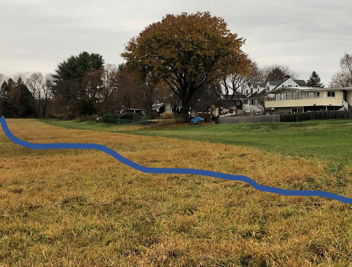
Twenty thousand years ago, if you stood roughly in the middle of the property, on the corner of Harlow Dr. and Frost Lane, and looked straight up, you would see an ice sheet two miles high. Two miles of crushing weight which had moved inch by inch from the north, dragging rocks and boulders and scaring the earth along the way. The weight of that frozen mass, under which nothing could live, created a tabula rasa upon which a new story of the land would be written. And then the ice melted. When the glacier had receded, the rift valley that would become the Connecticut River Valley remained and an east-west series of hills south of Hartford created a natural dam, backing up the flow of water running from the north and creating a long lake, later to be named Lake Hitchcock after the Amherst College professor who so loved this region.
The ice started to recede about 18,000 years ago and Lake Hitchcock began to form. Standing at the corner of Harlow and Frost, 16,000 years ago, you would have been on an island with its western shoreline just a few feet west of Ridge Crest Rd. The current UMass Agricultural Learning Center and much of the valley beyond were under water. You could see an island in the lake not too far out that is now Mt. Warner.

The shoreline of geological Lake Hitchcock was along a line west of the homes between Ridgecrest Rd. and the UMass Agricultural Learning Center (Beachfront properties).
When the glacier first receded, the island that is now part of North Amherst would have been nothing more than bare bedrock devoid of any life. Cracks in the rock caused by freezing and thawing trapped wind-blown soil and seeds, probably grasses at first which drove their tiny roots down into the crevice of the rock. Water trapped in the crevice would freeze and expand the crack even more, allowing the widening crack to catch yet more soil.

Lichens grabbed the rock and acids released by the lichen began to eat away at the hard rock surface. Over time, soil and debris and dead lichen materials began to accumulate and slowly, ever so slowly, soil began to accumulate in the cracks and along with the lichen, low growing mosses began to appear. But it was cold, and little else grew on this islane for a long time.

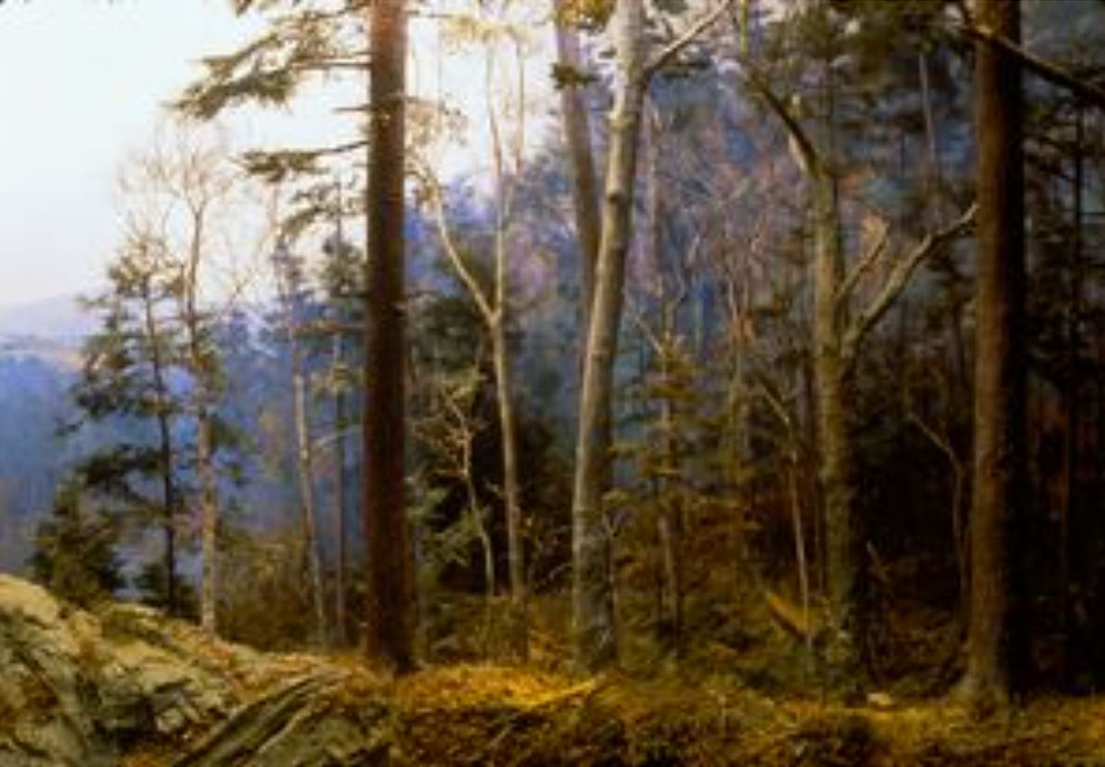
Then about 12,000 years ago, the pressure of all that water trapped by the hills in central Connecticut broke the dam that created the lake. The water rushed south to the Long Island Sound, opening the valley and giving other animals access to the former island which was now connected to the Pelham Hills. Birds bringing seeds of larger plants, shrubs and trees would continue the process of ecosystem succession as spruce and fir trees grew in the still cold climate. Larger animals such as squirrels, beavers, foxes, deer, caribou, bears and snakes and chipmunks arrived to feed on the young shrubs and trees. As the climate warmed, a rich ecosystem of grasses, shrubs and hardwood trees including hemlock, maple, beech and oak trees developed into a new forested landscape where there had only been bare rock.
The first humans to visit the corner of Harlow Dr. and Frost Lane (or at least the region nearby) were hunter-gatherers, passing through about 11,000 years ago. The First Peoples began to stay in the region around 6,000 years ago. They lived in movable villages with gardens on the river bottom soils along the Connecticut River and winter quarters in the forests farther up in the hillsides (near Amherst) where there was plenty of wood for winter fires.

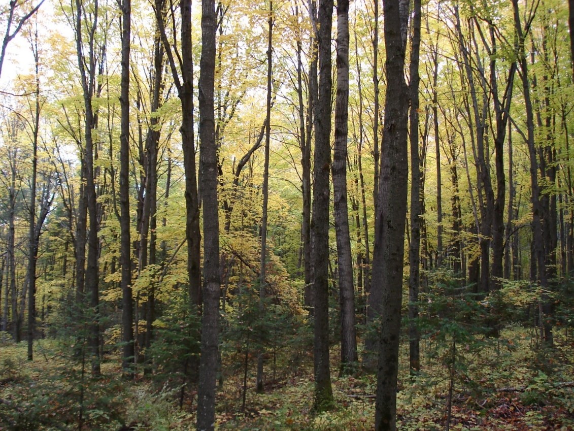
The First Peoples in the region learned to burn the understory of the forest in fast moving, mostly low temperature fires that opened the understory to make hunting easier. The burning also helped select for tree species that produced nuts and shrubs that grew back quickly and provided berries. The burning released nutrients from the burnt grasses that fed the remaining plants. This human-influenced ecosystem of relatively open hardwood forests was relatively stable and continued for about 6,000 years until the arrival of European settlers.
The arrival of Dutch settlers and fur trappers from New York in 1610 and English settlers from Boston and Plymouth in 1630 changed everything. The Nonotuck peoples occupying the land were decimated by disease and those that survived found themselves pushed off land they had occupied for thousands of years. Beaver trapping released dams and drained wetlands. New permanent housing structures displaced movable villages. Gardens that included the Three Sisters, intercropped species of corn, beans and squash, were replaced by more or less straight rows of European monoculture. And the trees came down rapidly. The tall pines in the valley were prized by the British navy for ship masts. And the old growth hardwood was burned to make way for pastures and fields.
While the first European settlements were built on the river bottom soils in Hadley and Northampton, as generations continued to expand, new families moved to the higher wooded areas farther up slope including the land at the corner of Harlow Drive and Frost Lane. The land appeared “empty” to the European settlers, as native populations had no fences for livestock nor “permanent” structures and were rapidly displaced.
Initially, the land that today is called Amherst, was “given” to Hadley families in order to graze livestock and cut firewood. The grounds that had formerly been stewarded by Native peoples for gathering fruits and nuts and the occasional hunting and fishing was taken by the new white settlers. While there is no evidence of Native villages in this immediate area, it was certainly part of the region Native peoples thought of as homeland. In this sense, all of our homes currently reside on stolen land. While not the subject of this blog, the much needed repentance and repair work is long over due.
The land that would become our neighborhood began to be cleared of trees around 1731 by Nathaniel Kellogg, who moved from a farm in Hadley at age 70 with his wife and youngest son, Ephraim, age 30, would become a working farm for the next 220 years.
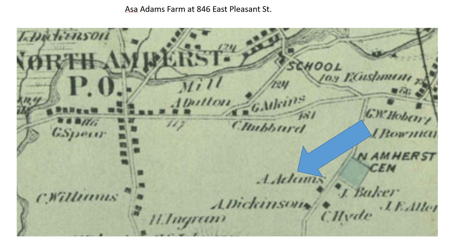
The first permanent house in our neighborhood was built in 1740-41 and was most likely the small house attached to the larger house in the picture below. This small house was subsequently separated from the main house and moved about 100 yards north. It is still occupied today and is at 858 East Pleasant St. The main house, which still stands at 846 East Pleasant St. was built by Ephraim Kellogg who operated an inn on the site from 1744 to 1756.


The Kellogg’s lived in the original farmhouse until 1757 when they sold the house and 60 acres to Elijah Baker of Northampton whose family occupied the home for almost 100 years. This was a period of mostly self-sufficient farming with some crops and livestock for local and regional sales. Sheep dominated the central New England landscape from 1810 to 1840 when textile mills grew rapidly due to a post-War of 1812 tariff imposed on English goods, including wool. The Baker family probably also grew broom corn which was made into brooms in Hadley during the first half of the 19th century.

In 1855, the property was sold to Asa and Carolyn Adams, who would have most likely maintained a mixed crop and livestock farm. Asa was active in town government and helped maintain the North Amherst Cemetery just up the road on East Pleasant St.. Fields were likely mixed hay, pasture, and corn, surrounded by hedgerows and tall trees for the cattle to find shade.
| In 1908, Asa Adams sold the farm to Ellis C. and Emma T. Harlow. The farm was run down at the time. Harlow arrived with five cows, two purebred Jersey calves and knowledge of scientific agriculture which was being promoted by Mass Aggie just down the street. Harlow was very successful and bought several surrounding farms, eventually managing 150 acres of hay, pasture and dairy. The Jerseydale Farm was a well-managed farm with as many as 100 Jersey cows (which was large for the time). Ellis bred cows and won prizes for milk production. They sold milk to Mass Aggie and Mt. Holyoke College. They probably removed many of the remaining trees and much of the hedgerow plants to open the fields to haying. Ellis died in 1946 and Ellis Jr. continued to manage the farm. |

Jerseydale Farm was a large dairy farm for the times with large barns and expansive fields of hay and pasture. This picture was an aerial shot taken prior to the sale in 1952.

Ellis Jr. also sold 7 acres and the original farmhouse to Frank Decker in 1952. This property is comprised of the triangle of land between Harlow and Rolling Ridge that remained undeveloped until recently.

In 1952, Ellis Jr. sold the land between Harlow, Ridgecrest and VanMeter to Walter C. Jones for development into “Grandview Heights”. These homes were built in the late 1950’s. The properties with larger lots on Rolling Ridge were developed about 10 years later.

Street Names
East Pleasant – the section near the North Amherst Cemetary was called “Cemetary St.”; the road was called “Pleasant St” and “Mount Pleasant Street” before finally being designated “East Pleasant St.” in 1895 as it ran east of Mt. Pleasant
Frost – named for poet, Robert Frost
Harlow – named after the Harlow family who managed Jerseydale Dairy from 1908-1952
Hartman – named for developer, Walter Jones’ wife, Sarah Hartman Jones
Ridgecrest – named by Walter Jones as descriptive of the topography
VanMeter – named for former UMass president, Ralph VanMeter
Acknowledgement and Sources
Those of us who live in North Amherst should acknowledge that we stand on historic Nonotuck land, recognizing also the neighboring indigenous nations, the Nipmuck and Wampanoag to the east, the Mohegan and Pequot to the south, the Mohegan to the west, and the Abenaki to the north.
The map of Grandview Heights was provided by Cinda Jones from the W.D. Cowls files.
Brown, W.R. 1920. Mr. E.C. Harlow is Making Some Good Records. The Jersey Bulletin and Dairy World.
Bruchac, M. 2004. Native Presence in Nonotuck and Northampton. IN: Kerry Buckley (Ed.), A Place Called Paradise: Culture and Community in Northampton, Massachusetts, 1654-2004.
Holland, P. G. and W. N. Robinson. 2012. Images of America: North Amherst and Cushman. Arcadia Publishing, Charleston, SC
Rainford, S. and R.O. Jones. 2010. Harvesting History: Amherst Massachusetts Farms – 1700-2010. Amherst Area Publications, Amherst MA
If you find any mistakes in this document or wish to suggest edits or additions, please contact:
John M. Gerber
123 Harlow Dr.

My Husband Robert Blair Cutting is the grandson of Bertha Harlow who was raised on that farm. His father was Roy Harlow Cutting